Resources
A collection of free resources to help you raise funds and share the work we do

About our charity
The Mission to Seafarers provides help to the 1.89 million people who face danger every day to keep our global economy afloat.

What is a seafarer
Support for anyone working in the seafaring industry
Our impact
Providing help for seafarers in over 200 ports around the world.
Our issues
Multiple issues effect Seafarers everyday, learn how we help
Our people
Learn more about the staff that make change happen
Careers
Impacts on the lives of people across the world
Publications
Explore our latest publications, reports, and stories showcasing the impact of our work.

Back
About our charity
The Mission to Seafarers provides help to the 1.89 million people who face danger every day to keep our global economy afloat.
What is a seafarer
Support for anyone working in the seafaring industry
Our impact
Providing help for seafarers in over 200 ports around the world.
Our issues
Multiple issues effect Seafarers everyday, learn how we help
Our people
Learn more about the staff that make change happen
Careers
Impacts on the lives of people across the world
Publications
Explore our latest publications, reports, and stories showcasing the impact of our work.

Where can I get help?
We are here for you 24/7
Download our app
The first digital seafarers’ centre in your pocket.

Find a port
We’re located in over 200 ports in 50 different countries
Family network
Learn more about the community we’re building for seafarers’ families
The Sea
The latest maritime news and safety information for seafarers.
WeCare
An initiative designed to improve the mental health and wellbeing of seafarers
Training
We have a range of e-learning for seafarers and their families
Seafarers happiness index
A platform for seafarers to share their views and be a catalyst for change
Contact our Chaplaincy team
Support for anyone working in the seafaring industry
Back
Where can I get help?
We are here for you 24/7
Download our app
The first digital seafarers’ centre in your pocket
Find a port
We’re located in over 200 ports in 50 different countries
Family network
Learn more about the community we’re building for seafarers’ families
The Sea
The latest maritime news and safety information for seafarers.
WeCare
An initiative designed to improve the mental health and wellbeing of seafarers
Training
We have a range of e-learning for seafarers and their families
Seafarers happiness index
A platform for seafarers to share their views and be a catalyst for change
Contact our Chaplaincy team
Support for anyone working in the seafaring industry

Make a donation
With your help we can be there for everyone that needs us

Events
Learn more about our global programme of events

Legacy
Support us with a legacy gift.
Back
Make a donation
With your help we can be there for everyone that needs us
Events
Learn more about our global programme of events
Legacy
Support us with a legacy gift.
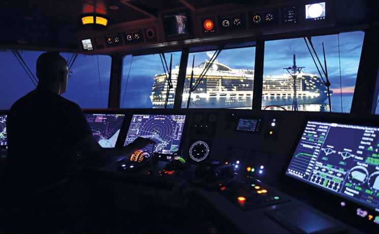
Felicity Landon shares advice on how to react to and deal with positioning interference
Incidences of AIS and GPS jamming and spoofing have rocketed since the outbreak of war in the Persian Gulf. What can, and should, seafarers do if their ship is in a conflict zone with no reliable position?
“People were navigating around the world for thousands of years without using satnav,” says Gregor Stevens, nautical director at the International Chamber of Shipping (ICS). “Only in the early 2000s did we get to technology giving a constant position fix. The main thing is the training that seafarers have – they are trained to navigate without a satellite position.” Stevens was at sea for 12 years, gaining his master’s ticket before coming ashore two years ago. The ICS is contributing to the current International Convention on Standards of Training, Certification and Watchkeeping for Seafarers (STCW) review and he warned: “A lot of people have been saying celestial navigation is obsolete. But considering what is going on, a lot of these principals of navigation are still very important. Knowledge and the fundamentals of position fixing are important because of what we are seeing with interference with all the satellite signals.”
Andy Glen, loss prevention director, Asia Pacific, at NorthStandard P&I club, noted that while jamming and spoofing is not a new issue, it is now “more prevalent and being used by state actors”, including in the Red Sea, lack Sea, Persian Gulf and Indian Ocean.
“It’s really down to the watchkeeping officers on the bridge being alive to what the issues are and getting back to some of the more traditional practices when it comes to navigation and position fixing that are required,” he said. “I think most watchkeepers are managing and doing it well; that just comes down to a level of preparedness. There is a better degree of awareness, reports come in and are shared, and people are more alert to it happening.”
He emphasised the preparations a ship should make before going into locations where interference is well reported. “Crew should know when doing the vessel’s voyage risk assessment what the likely risks and threats are and the likely impact. They should know what systems could be affected, the procedure to isolate the potential threat before they get there, and how to deal with it once they are in that environment.
“Before entering these areas, they should be thinking about disconnecting the really sensitive equipment. And a fundamental thing taught in bridge watchkeeper training is that you never rely on one source of information when fixing the position of the ship.”
Avoiding complacency
It’s human nature to choose the path of least resistance, said Glen – after all, most people are susceptible to the convenience of Google maps and satnav in cars, and get out of the habit of doing things the way we used to. Complacency can creep in, especially since electronic charts have become prolific across the industry. “It is still legal to use paper charts where positions are manually charted. For that, you have to take bearings and distances from known points of land or lighthouses or coastal features and physically plot on the chart. You can still do that on electronic charts if you disconnect – you can use radar range rings to measure the distance from a known point of land. These are traditional coastal navigation techniques which watchkeepers should be familiar with and should be doing anyway to cross-check their positioning.”
Some challenges are more difficult. “If jamming takes place, it’s pretty obvious – you would have alarms going off on the pieces of equipment that aren’t able to function. With spoofing, sometimes you know there’s a problem, sometimes you don’t. It’s more nuanced.”
Spoofing could gradually introduce an error of bearing or latitude/longitude – small incremental measures so the bridge team might not be immediately aware they have a problem.
“There could be a lack of awareness that the systems aren’t working as well as they should if you are not cross-referencing with other techniques. It’s human nature – you see the information presented to you on the screen, and 50 weeks of the year it’s accurate and you can rely on it, and then two weeks it’s not.”
The Royal Institute of Navigation (RIN) warns that any equipment affected can retain the wrong information even after leaving the area where the attack has taken place and recommends powering off and on to remove corrupt data from the system.
“If you have powered down in advance, it’s easier to power up again when you are out of the affected area,” says Glen.
Understand your systems
In its recent report, the RIN outlined the risks and actions to be taken relating to GNSS/GPS interference. For example, spoofing can cause the displayed position on ECDIS to change rapidly. The operator needs to know how to put their ECDIS into different modes to ignore the incorrect GNSS data; some manual intervention is required to return it to normal functioning after interference.
Time calculations can be affected, causing digital licences to ‘expire’ and so charts to disappear from systems. The gyrocompass can lose accuracy, Speed Over Ground can be unavailable or inaccurate, and the autopilot could incorrectly manoeuvre the vessel and have to be manually disabled. Emergency Beacon technologies – Man OverBoard and GMDSS (Global Maritime Distress and Safety System) alerts, for example – depend on an accurate position fix, but interference could stop the emergency broadcast or send out an incorrect position.
Understanding that positioning information feeds into a lot of critical systems is a key precautionary step, said Andy Glen. “The crew need to know what information is compromised. They need to know which systems they can no longer rely on and what plan B is, in order to do what that piece of equipment used to do.”
As to navigation solutions, parallel indexing is a simple pilotage technique which can be used in coastal waters, with no link to GPS or satellite positioning. “There are several practical navigation techniques, tried and tested for decades, which watchkeepers should still be using,” he said. “But these are professional navigators – the definition of professional is to be doing something repeatedly, expecting it to be different every time you do it. You always approach the task as if it’s the first time you have done it and prepare for all eventualities.”
The ICS’ Stevens also emphasised that ‘traditional’ navigation techniques are not alien to seafarers – they are still on the syllabus for cadets. “Even before the current issues, you could occasionally have problems with GPS anyway. The first thing you will get is alarms on the bridge as soon as you don’t have a GPS input. There may be five or six pieces of equipment alarming at you – for autopilot, automatic charts, radio communication, and so on. So, the first issue is silencing the alarms and making sure you are dealing with them.”
While older seafarers may have more experience with traditional techniques, younger seafarers offer the advantage of more recent training and are often more tech savvy, he said. “If you have an issue with your electronic chart changing from GPS to manual fix, younger seafarers will be more used to using that.”’
He warned that GPS interference could happen without setting off any alarms – other identifiers to look out for include an off-match with the radar and a sudden position jump from your last position.
“There are small indicators that the crew need to be aware of. If you have had the correct STCW training, you should be able to spot them.”
Accident investigations often conclude by highlighting the importance of watchkeepers not relying solely on one type of electronic input but using their eyes and ears too, said Stevens.
Taking steps
The RIN’s recommendations relating to GNSS interference, for masters, navigators and officers of the watch, are to maintain an accurate connectivity diagram; understand and follow the vessel’s cybersecurity policy; understand onboard equipment; maintain awareness of where GNSS interference may be encountered; share knowledge and experience and maintain training; and ‘report, report, report’ to the appropriate authorities, the vessel’s owner/operator/manager, and the relevant equipment providers.
Of course, the experience of individual seafarers in situations such as these depends on the type of ship, Stevens noted. A large vessel that is part of a high-performing company will likely have a strong shoreside operation centre and provide a lot more input; a small vessel being run by a two vessel owner/operator will not have that level of support.
“But VTS are there for a reason, to assess and help. They will notice if there are AIS problems. You really need to use all available means to assist you.”
Looking at the broader picture, there are tech developments being discussed. The EU has submitted a submission to the IMO for R-Mode (ranging mode), a terrestrial positioning system that can kick in if GPS is down. While GPS is the most widely used system, there could be the option of using multiple GNSS systems such as Galileo and BeiDou, through a receiver that could automatically switch from one signal to another.
Starlink and other commercial satellite systems could also provide a solution, said Glen, and NorthStandard is investigating what it could provide to members in that area.
“We do recognise that this is a serious issue and if signals are lost or people are misinterpreting information on the bridge, there is a risk of collision or grounding, leading to claims – and anything that can reduce that risk, we want to invest in. It’s about education and also what we can provide in terms of practical solutions. And it also requires an investment from operators.”
What about the risk if another ship in the vicinity has switched off its AIS, whether for innocent reasons or because it is involved in nefarious activities? Glen said that in collision avoidance, case studies often show watchkeepers spending too much time trying to contact the other ship to find out what they are doing, rather than focusing on what they can do to avoid the collision.
“You don’t need to know the name of the ship to know the position of the ship in order to take action. We are just going back to that set of circumstances where you no longer have that information – but it shouldn’t stop you understanding the rules of the road and taking sufficient action to stay out of the way. That should have been taught as part of STCW training.”
The importance of preparation
In conclusion: training and preparation are key. “It will be more stressful for seafarers if they are not prepared,” said Glen. “For a junior watchkeeping officer going anywhere near the Persian Gulf area, the master or chief officer should be talking to them about the risk and the threat and how they are going to manage it. We would expect that individual to be asking ‘how do you want me to respond if I am concerned about the accuracy of this, or if things are not matching up as they should’. That should be discussed.
“In loss prevention sessions, we encourage a positive challenge with positive intent culture. If you have a concern, you should be comfortable to raise that in a civilised way to satisfy your curiosity. Sometimes it’s the youngest, newly qualified individual who knows the most about a particular piece of equipment. Senior officers should recognise that expertise in the junior officer and learn from it.”
Finally, he warned, there is a wide degree of variability in how management companies, company security officers and the senior management team on board prepare the crew for circumstances such as these.
“Seafarers can only do what they have been trained to do and then they are dependent on their employers and senior leadership team being up to speed on issues and telling them what to do.”
1.89 million people work at sea, and with your help we can be there for everyone that needs us.